Are you Wondering where to go Adventurous in small Switzerland of Uganda?
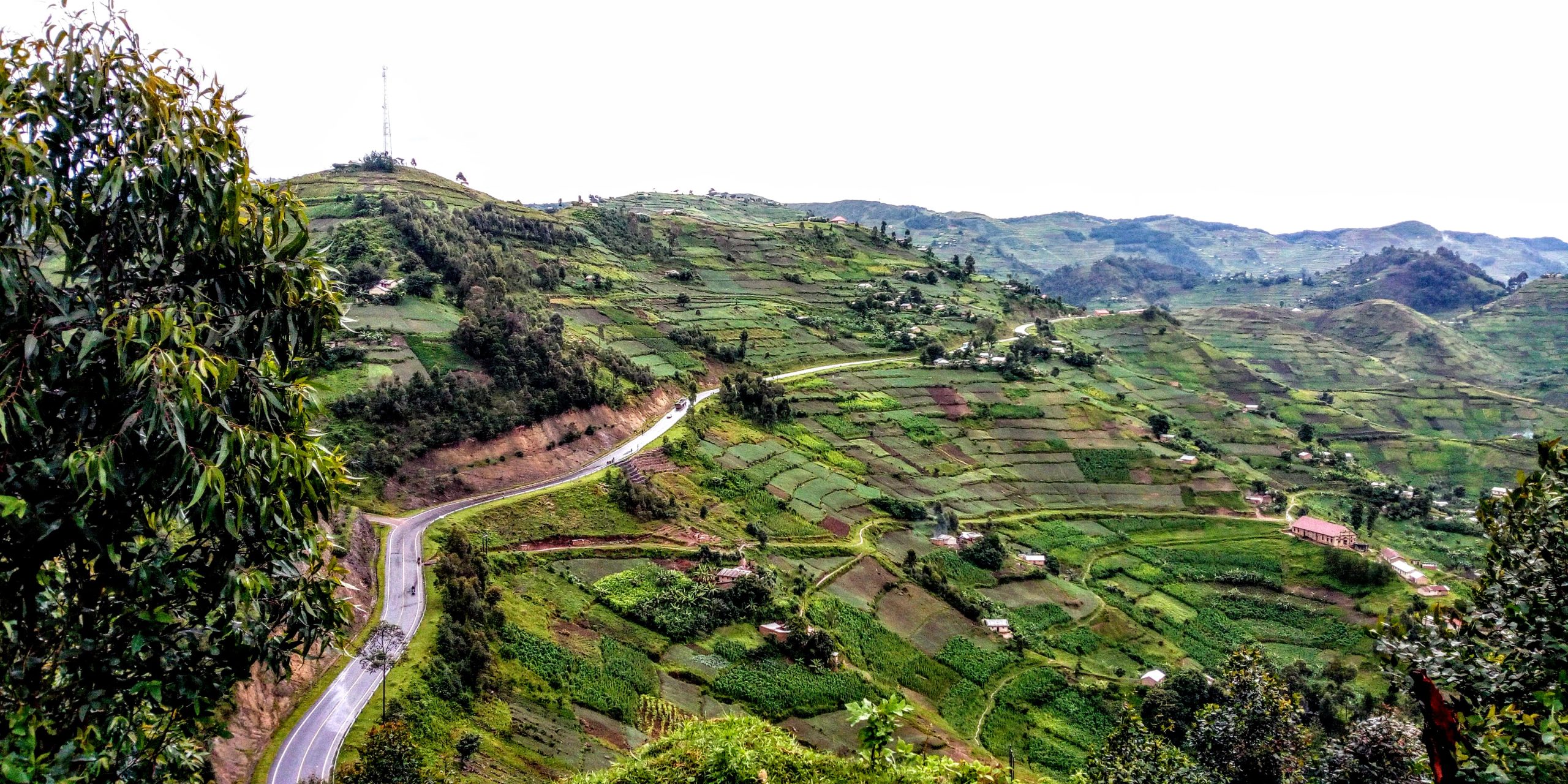
Nestled in Nyakabande, Kisoro District, Kigezi Hill is more than a geographical landmark—it is the origin of the name “Kigezi Region” and a gateway to gorilla tracking adventures. This modest hill, crowned by a mysterious lake fringed with papyrus reeds, holds layers of ecological, cultural, and historical treasures that continue to shape the lives of Ugandans and their Neighbors.
![]()
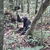
Bwindi Heritage Site- The Ultimate Gorilla Tracking Experience
Nature’s Hidden Wonders-Gikubire Caldera: A dramatic volcanic depression beside the lake, adding geological intrigue to the landscape.
The Lake of Kigezi acts as lifeline for surrounding communities, its depth still unknown to environmentalists. It feeds the Nyamigogo rock stream through underground channels.
The Lake of Kigezi-A Lifeline and a Mystery
Ecologically, the lake beside Kigezi Hill has long been a vital source of water for surrounding communities. For generations, it was the place where families fetched water for cooking, drinking, and daily life. In Kisoro, elders would say, “You cannot eat before you go to Kigezi.” Carrying a small jerrycan on your head was a rite of passage—until bicycles came along and changed the rhythm of the journey. But this lake is more than a water source. It is a mystery:
Its depth remains unknown, even to environmentalists. Locals speak of its unpredictable nature, its silence, and its hidden power.
A childhood memory lingers—I recalls a day when we went to fetch water with my sister. She slipped, and the lake nearly claimed her. An elder, quick and strong, pulled her out by the hair. She survived, but the lake’s danger was never forgotten.
This lake also connects to the land-through underground rock channels, it feeds the Nyamigogo stream, sustaining ecosystems beyond its visible edge. Locals use its secluded waters to protect beehives, placing them inside the lake’s perimeter where intruders cannot reach.
Papyrus and the Path to Marriage-a tradition rooted in Kigezi Hill
At the heart of Kisoro’s cultural identity lies a quiet lake beside Kigezi Hill, fringed with swaying papyrus reeds. These reeds are more than plants—they are threads of tradition, woven into the lives of young women preparing for marriage.
In this community- Unmarried girls gather papyrus from the lake’s edge, learning the art of weaving from mothers, aunties, and grandmothers. Weaving mats is a rite of passage—a symbol of readiness, skill, and womanhood. When a girl is sent to her husband’s home, she carries the mats she has woven herself. A girl who cannot weave is considered unprepared for marriage. The craft is not just practical—it is a measure of grace, patience, and cultural pride. This skill is passed down through generations, linking daughters to mothers, and preserving the rhythm of tradition.
The lake, with its papyrus reeds, becomes a classroom, a sacred space, and a symbol of continuity. It is where culture is practiced, preserved, and celebrated—one mat at a time.
Kigezi Hill often carry cultural weight, serving as sites for storytelling, rituals, and communal decision-making. For Kisoro residents, Kigezi Hill is tied to regional pride and heritage.
Kigezi Hill-Where Borders Were Drawn and Cultures United
Kigezi Hill is in Kisoro District, southwestern Uganda, near the borders with Rwanda and the Democratic Republic of Congo. The hill is part of the scenic Kigezi highlands, known for their rolling hills, volcanic ranges, and lush vegetation. This hilly is Strategically Positioned due to its proximity to international borders made it a secure yet influential retreat for political leaders
Field Marshal Idi Amin Dada, Uganda’s president from 1971–1979, chose Kigezi Hill as a personal retreat. His hut on the hill hosted meetings with Kisoro’s community leaders, blending national politics with local voices. By situating himself there, Amin reinforced the hill’s political relevance, making it part of Uganda’s national memory. The location allowed Amin to project authority in a region critical to Uganda’s relations with neighboring countries.
https://mulerasfireplace.com/kigyezi-2/history/
In the early 1900s, Kigezi Hill in Kisoro District became a pivotal meeting ground for colonial powers—Belgium, Britain, and Germany. Around 1910, representatives from these nations gathered here to negotiate territorial control over Uganda, Rwanda, and the Democratic Republic of Congo (DRC). What unfolded at this modest hill would reshape the region’s geography and cultural landscape for generations.
Unlocking Echuya’s Potential for Sustainable Eco-tourism and responsible travel in Kisoro-Uganda
Man-made caves and trenches still mark the landscape at Murambi, Gihinga Caldera, and Chahafi near the Rwanda-Uganda border. These remnants whisper of colonial negotiations and wartime tensions that once gripped the region.
Borders Shaped by Mountains, the Virunga volcanic chain became the natural blueprint for boundary lines, Mount Muhabura was shared between Uganda and Rwanda-Mount Sabyinyo was split among three nations—Uganda, Rwanda, and the DRC. These divisions altered the geographical size and political boundaries of each country.
Cultural Continuity Across Borders
Despite the imposed borders, the people of Kisoro, North Kivu (DRC), and Rwanda remained deeply connected with Shared language and traditions continue to unite communities across the region. Intermarriages between tribes have flourished, reinforcing bonds that colonial lines could not separate. Kisoro District, bordering Rwanda, remains a living example of cross-border heritage and unity. for arrangement of one day excursion, its scenic beauty and historical significance make it a potential heritage site for visitors interested in Uganda’s political past. While some view it as a reminder of Amin’s authoritarian rule, others see it as a landmark of regional importance.